sursa:
www.comunasolonț.ro


TOWN HISTORY
Situated in the north-west of the Carpathian Basin Tazlăului through soil and subsoil wealth by its varied landscape, the village Solonţ favored the early construction and development of human settlements. attested oldest village on the village was Cristeşti, Calmuş the valley, the village disappeared today. Village name may come from an ancient Cristea.
On
November 3, 1471, he gave Stephen the Great's Danciul Boldaş Cristeşti
village on Calmuş, a solitary place in the mouth of the brook Muncel
Solonţ as to found the village, half of the Muncel clearing and Poieniţa Horse. From Boldaş Danciu's successor,
by purchase, the village came in the early sixteenth century under the
rule of the great nobleman Cosma Snake. In 1518 he changed Cristeşti village and village Ilişeşti four parts, with Peter, former chief magistrate, son of Pasco Haciuga.
Solonţ
was established as a settlement from the gradual displacement of the
population in villages and Boldăşeşti Cristeşti on Solonţ valley, in the
second half of the sixteenth century - the beginning of the seventeenth
century.
RELIEF
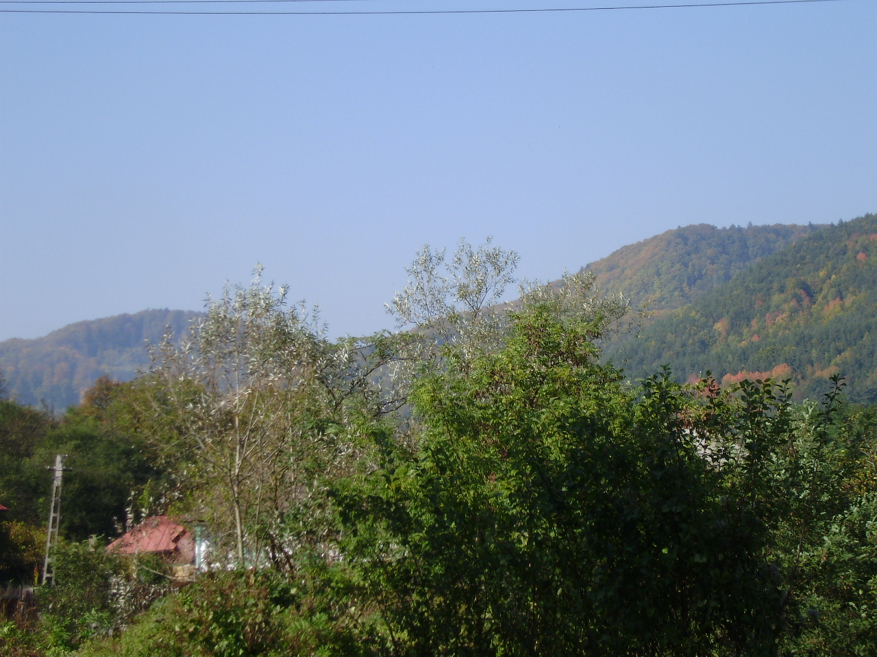
In terms of geo-morphology, the village Solonţ covers two distinct
areas, namely the Eastern Carpathians and the Carpathian basin
Tazlăului. Carpathian mountains to a high degree of
fragmentation of the landscape, with altitudes reaching 700 - 1000 m
(top Sloga. 975.00 m, Stone Hawk. 816.00 m). The valleys are deep, narrow and rocky walls. Tazlăului basin area has a hilly terrain, with ridges oriented roughly northeast to southwest coming down the river Tazlău. The
hills have altitudes between 400-700 m, a highly fragmented landscape
with steep slopes, especially in the north-west, being affected by
surface and deep erosion (gullies, torrents) and of the slides land.
GEOLOGY
From geological, Solonţ village is ordered into the Carpathian hills, characterized by a daily occurrence in Miocene sediments, consisting of sandstone lithology coarse green and gray-green marly clay, looking breccios. Contains Miocene deposits of oil, mining, itself, the village is included in a Solont oil field. Soil types most commonly identified within the village are Solonţ brown acid soils, and podzolic pseudorendizinela leachates. Brown soils with weak podzolic horizon are spread on the lower terraces (plateaus and the slopes of their uniform tilting 1-4 °). Fertility of these soils is low. It is characterized by a strong acid reaction. To increase fertility of these soils are calcareous amendments necessary to correct acidity accompanied by the application of fertilizer nitrogen, phosphorus and potassium. Pseudorendezonele are found on slopes with variable tilt to 14 ° -16 ° with a low fertility better on slopes prone and mediocre fertility on slopes fast. Generally these soils are medium productivity, such as fertilizers are required consisting of manure and chemical fertilizers in the form of phosphates and nitrates used in variable dose depending on the type of soil degradation and erosion degree.
RIVER
The hydrographic network is well developed, almost every valley has a permanent water course, due to the abundant springs in the mountains and rain quite often.
main water courses crossing the village area Solonţ are:
- River flows from the large forest of Solonţ Zemeşului, flows eastward through the villages Solonţ and Salt and flows into the territory of Great Tazlăul scorched;
- Cucuieţi stream flows from the large forest called Dosul Lake, flows eastward and flows throughout the municipality Tazlău scorched.
- Calmuş stream is located in the south of the village Solonţ, flows to the southeast and flows into the Salt Tazlăul downstream of the village within the village Ardeoani Leontineşti.
Cucuieţi Creek Lake is formed from the confluence of rivers with a length of 3.5 km and 7 km long Bratu .
tributary stream brook Parasca Calmuş is 1.3 kilometers long. Water of these streams contain many minerals (Cl, Na), and residues from oil exploitation, which make them unusable.
In addition to these permanent streams and valleys that are seasonal or only water from heavy precipitation, due to drainage basin binding and sands which drain underground rain diluviene 2005 precipitaţiile.După experience, we can not guarantee that the valley is not
at risk of flooding.
DEEP WATERS
Groundwater is not in continuous horizon than in the meadow and the main valleys, which is mostly due to the conditions of relief. Thus, the valleys and lower terraces is seen from 0.50. 5.00 m on average between 5.00 terraces. 10.00 m, and some slopes between 10.00. 20.00 m
Spatial Plan highlights the following issues Bacau County and failures on the river, problems and failures that are reflected in the village Solonţ:
- uncontrolled flow of torrents and uninsured;
- nestabilizarea water banks;
- neregularizarea banks ,
- are not prepared cadastres river basin;
- streams existing in the commune is not a source for specific tourism organization and is not used for irrigation, fisheries, recreation.
CLIMATE
Solonţ village area is part of a temperate continental climate, with strong local influences caused by the relief. The local climate is characterized by average annual temperature of 8.40 C, with lowest values in January: -330 C and the highest values in
July: 19.50 C.
The winds are harsh and blowing mainly from the north and west . Channeling of cold currents is from Salt Tazlăului mountain valley. In the rain can not take into account multi known value of 550 mm / year, due to climate change currently occurring in Europe. Rains this year have exceeded this value, causing extensive erosion and flooding. The dry periods are autumn, while those with excess moisture in early summer. Closely related to the thermal regime, remember the phenomenon of frost, frost, ice and frost. Frost is a phenomenon linked to maritime air supply, arctic or temperate maritime intense air cooling. Bruma is the clear nights of spring-autumn. Fog is a common phenomenon throughout the year at higher altitudes and transition seasons at lower altitudes.
Seismicity DEGREE
P100/92 MLPAT developed according to norm (Standard for the seismic design of housing, socialculturale, agribusiness, industrial), the village is set in D, with Ks = 0.16 and Tc = 0.7 sec period, specific seismic level VII.
minimum depth of foundation will be about 1.20 m, depth of freezing of the foundation soil is this area of 0.90 m, according to STAS 6054/1997. Avoid foundation soils or filler plant, aiming to bow to earth galbencenuşiu loess. Foundations will be designed to transfer land a maximum pressure of 1.0 kgf / cm ² for basic tasks. A foundation base width of 0.5 m satisfy this requirement for a single level building, of brick.
The vegetation
The vegetation in the village Solonţ
is characterized by a variety of species and natural setting of the
land given that altitude. Woody vegetation is represented by the large forest area with characteristic mountain woods: pine, spruce, etc.. In the hills of deciduous vegetation is represented by beech, hornbeam, oak. On the banks of streams, indicating an excess of moisture is found alder, poplar, willow etc.. Of herbaceous vegetation meets Fretusca pratensis, koeleria gracilis. Of cultivated plants thrive wheat, corn, rye, etc..VILLAGE AREA
Administrative territory of the village area is 5210.11 ha. The total area occupied by villages buildable is 375.33 ha, representing 7.20% of total suprafaţri village.
Solonţ administrative territory of the village include: Agricultural land: 2938.99 ha of which: - 1011.36 ha farmland - pasture and hay 1901.72 hectares - 25.91 ha vineyards and non-agricultural land: 2272.11 ha of which: - forests. 2059.49 ha - ha water and reeds 31.48 - 58.76 hectares roads - Construction 89.72 ha - ha unproductive 32.66
MEDIA DIAGNOSIS surrounded
Excessive industrial and economic development, made after the Second World War did not take into account the specific rationale for environmental protection and pollution led to the country, the Bacau County, including the area of the village Solont. It is true that industry declined after 1990, some industries have even disbanded.
Solont common sources of pollution are:
- -Households, the source generating the emissions standards of home heating systems (emissions of nitrogen oxides, sulfur oxides, carbon oxides) in close connection with nature fuels, the height of chimneys and the concentration per unit surface
- Traffic-generating exhaust emissions from vehicles in traffic. Pollutants emitted (sulfur and nitrogen oxides, acrolein, lead and heavy metals, volatile organic compounds) are quantitatively determined by the value of recorded traffic, engine type and distance from highways
- Service-units (bars)
- -Latrines and wells dry absorbent type of households may affect groundwater
- -Existence of unauthorized storage area for household waste (in the valleys on the edge of buildable, the water bank, etc..)
In the village there Solont landfills platform built to European standards. City Council Solont is associated with other municipalities and city Moinesti to achieve landfill project. This landfill will be located in the city Moinesti.
NATURAL RESOURCES
former oil mine Solont

former oil mine Solont
The main natural resources found within the village lies in the
richness of surface and ground water, forests, pastures, meadows and
orchards, vineyards, vegetable and mineral resources: oil and sulphurous
waters. Solont the village were in the past about 150 wells to extract oil. Mining Area is located in the north and south part. Sulphurous waters are not used scientifically.
Aşezat în partea de nord-vest a Depresiunii subcarpatice a Tazlăului, prin bogăţiile solului şi ale subsolului, prin relieful său variat, teritoriul Comunei Solonţ a favorizat de timpuriu construirea şi dezvoltarea aşezărilor umane. Cel
mai vechi sat atestat documentar de pe teritoriul comunei a fost
Cristeşti, de pe valea pârâului Calmuş, sat dispărut astăzi. Denumirea
satului vine poate de la un străvechi Cristea.
La
3 noiembrie 1471, Ştefan cel Mare îi dădea lui Danciul Boldaş satul
Cristeşti, pe Calmuş, un loc pustiu la vărsarea pârâului Muncel în
Solonţ, ca să-şi întemeieze sat, jumătate din poiana de la Muncel,
precum şi Poieniţa Calului. De la urmaşul lui Danciu Boldaş, prin
cumpărare, satul a ajuns la începutul secolului al XVI-lea în
stăpânirea marelui boier Cosma Şarpe. În 1518 el a schimbat satul
Cristeşti şi patru părţi din satul Ilişeşti, cu Petru, fostul pârcălab,
fiul lui Pasco Haciuga.
Solonţ
s-a constituit ca aşezare în urma deplasării treptate a populaţiei din
satele Cristeşti şi Boldăşeşti, pe valea pârâului Solonţ, în a doua
jumătate a secolului al XVI-lea - începutul secolului al XVII-lea.
RELIEF
Din punct de vedere
geo-morfologic, teritoriul comunei Solonţ se întinde pe două zone
distincte, şi anume Zona Carpaţilor Orientali şi zona depresiunii
subcarpatice a Tazlăului. Zona carpatică muntoasă prezintă un grad
ridicat de fragmentare a reliefului, având altitudini ce ating 700 -
1000 m (vârful Slogul . 975,00 m, Piatra soimului . 816,00 m). Văile
sunt adânci, înguste şi cu pereţi stâncoşi. Zona depresiunii Tazlăului
are un relief deluros, cu culmi orientate aproximativ nord-est la
sud-vest ce coboară către râul Tazlău. Dealurile au altitudini
cuprinse între 400 - 700 m, un grad mare de fragmentare a reliefului
cu versanţi abrupţi, mai ales în partea nord-vest, fiind afectate de
eroziuni de suprafaţă şi de adâncime (ravene, torenţi), cât şi de de
alunecări de terenuri.
GEOLOGIA
Din punct de vedere geologic, Comuna Solonţ se dispune în unitatea pericarpatica, caracterizandu-se prin aparitia la zi a sedimentelor miocene, constituite litologic din gresii grosiere verzui şi argile marnoase cenusii-verzui, cu aspect breccios. Miocenul contine zacaminte de petrol, în exploatare, propriu zis, teritoriul comunei Solont este inclus intr-un câmp petrolifer. Tipurile de sol cel mai frecvent identificate pe teritoriul Comunei Solonţ sunt soluri brune acide, soluri podzolice precum şi pseudorendizinela levigate. Soluri brune cu orizontul A slab podzolit sunt raspândite pe terasele joase (platouri precum şi pe versanti uniformi cu înclinare de le 1-4°). Fertilitatea acestor soluri este redusa. Se caracterizeaza printr-o reactie puternic acida. Pentru ridicarea fertilitatii acestor soluri sunt necesare amendamente calcaroase pentru corectarea aciditatii însotita de aplicarea îngrasamântului cu azot, fosfor şi potasiu. Pseudorendezonele se întâlnesc pe versanti cu înclinari variabile până la 14°-16° având o fertilitate mai buna pe pantele slab înclinate şi o fertilitate mediocra pe pantele mai repezi. In general aceste tipuri de sol sunt de productivitate mijlocie, astfel ca sunt necesare îngrasaminte constând din gunoi de grajd şi îngrasaminte chimice sub forma de fosfati şi azotati aplicate în doza variabila functie de tipul de sol şi de gradul degradarii sau eroziunii.
REŢEAUA HIDROGRAFICĂ
Reteaua hidrografică este foarte bine dezvoltată, aproape fiecare vale are un curs permanent de apă şi aceasta datorită izvoarelor abundente din zona muntoasă şi a precipitaţiilor destul de dese.
Cursurile de apă principale care traversează suprafaţa comunei Solonţ sunturmătoarele:
- pârâul Solonţ izvorăşte din masivul păduros al Zemeşului, curge către est prin satele Solonţ şi Sarata şi se varsă în Tazlăul Mare pe teritoriul comunei Pîrjol;
- pârâul Cucuieţi izvorăşte din masivul păduros denumit Dosul Lacului, curge către est şi se varsă tot în Tazlău pe teritoriul comunei Pîrjol.
- pârâul Calmuş se află în zona de sud a localităţii Solonţ, curge către sudest şi se varsă în Tazlăul Sărat în aval de satul Leontineşti pe teritoriul comunei Ardeoani.
Pârâul Cucuieţi se formează din confluenţa pâraielor Lacu cu lungimea de 3,5 km şi Bratu cu lungimea de 7 km.
Afluentul pârâului Calmuş este pârâul Parasca cu lungimea de 1,3 km. Apa acestor pâraie conţine foarte multe săruri minerale (Cl, Na), precum şi reziduuri de la exploatările petroliere, datorită cărora sunt neutilizabile.
Pe lîngă aceste cursuri de apă permanente există şi văi care au apă sezonier sau numai la precipitaţii mari, datorită bazinului colector restrîns şi a nisipurilor care drenează în subteran precipitaţiile.După experienţa ploilor diluviene din 2005, nu mai putem garanta care vale nu
prezintă risc de inundare.
APELE DE ADÂNCIME
Pânza freatică nu se găseşte în orizont continuu decât în luncă şi în văile principale, fapt care este datorat în cea mai mare parte condiţiilor de relief. Astfel, pe văi şi terase inferioare este întâlnită între 0,50 . 5,00 m, pe terasele medii între 5,00 . 10,00 m, iar pe unii versanţi între 10,00 . 20,00 m.
Planul de Amenajare a Teritoriului Judeţean Bacău evidenţiază următoarele probleme şi disfuncţionalităţi referitoare la reţeaua hidrografică, probleme şi disfuncţionalităţi care se reflectă şi la nivelul comunei Solonţ:
- scurgerea necontrolată şi neasigurată a torenţilor;
- nestabilizarea malurilor apelor;
- neregularizarea malurilor;
- nu sunt întocmite cadastrele privind bazinele hidrografice;
- pâraiele existente pe raza comunei nu constituie o sursă pentru organizarea unui turism specific şi nu este folosit pentru irigaţii, piscicultură, agrement.
CLIMA
Zona comunei Solonţ se înscrie într-un climat temperat continental, cu puternice influenţe locale determinate de către formele de relief. Climatul local este caracterizat prin temperaturi medii anuale de 8,40 C, cu cele mai scăzute valori în ianuarie: -330 C şi cele mai ridicate valori în
iulie: +19,50C.
VÂNTURILE sunt aspre şi suflă preponderent dinspre nord-vest şi vest. Canalizarea curenţilor reci se face dinspre munte pe valea Tazlăului Sărat. În privinţa precipitaţiilor nu se mai poate lua în consideratie valoarea multianuală cunoscută de 550 mm/an, datorită unor schimbări climatice care se produc în prezent în Europa. Ploile din acest an au depăşit cu mult această valoare, provocând eroziuni şi inundaţii ample. Perioadele cele mai secetoase sunt toamna, iar cele cu exces de umiditate la începutul verii. În strânsă legătură cu regimul termic, amintim şi fenomenele de îngheţ, brumă, polei şi chiciură. Chiciura este un fenomen legat de aducţia aerului maritim, arctic sau de răcirea intensă a aerului temperat maritim. Bruma apare în nopţile senine de primăvară-toamnă. Ceaţa este un fenomen frecvent tot anul la altitudini mai mari şi în anotimpurile de tranziţie la altitudini mai mici.
GRADUL DE SEISMICITATE
Conform normativului P100/92 elaborat de M.L.P.A.T. (Normativ pentru proiectarea antiseismică a construcţiilor de locuinţe, socialculturale, agrozootehnice, industriale), teritoriul comunei este amplasat în zona D, având Ks = 0,16 şi perioada de Tc = 0,7 sec, specifice gradului seismic VII.
Adâncimea minimă de fundare va fi de circa 1,20 m, adâncimea de îngheţ a terenului de fundare fiind pentru această zonă de 0,90 m, conform STAS 6054/1997. Se va evita fundarea pe soluri vegetale sau de umplutură, urmărindu-se a se funda pe pământ loessoid galbencenuşiu. Fundaţiile vor fi dimensionate pentru a transfera terenului o presiune maximă de 1,0 kgf/cmp pentru sarcinile fundamentale. O lăţime a tălpii fundaţiei de 0,5 m satisface această cerinţă în cazul unei construcţii cu un singur nivel, din zidărie de cărămidă.
VEGETAŢIA
Vegetaţia din zona comunei Solonţ se caracterizează printr-o mare varietate a speciilor şi o pronunţată etajare pe teren ca altitudine. Vegetaţia lemnoasă este reprezentată prin masive păduroase cu specii lemnoase caracteristice zonei de munte: brad, molid, pin etc. În zona dealurilor vegetaţia de foioase este reprezentată prin: fag, carpen, gorun. Pe malurile pâraielor, indicând un exces de umiditate se întâlneşte arinul, plopul, salcia etc. Din vegetaţia ierboasă se întalneste Fretusca pratensis, koeleria gracilis. Dintre plantele cultivate se dezvoltă bine grâul, porumbul, secara etc.
SUPRAFATA COMUNEI
Suprafata teritoriului administrativ al comunei este de 5210,11 ha. Suprafata totala ocupata de intravilanele satelor este de 375,33 ha, reprezentând 7,20% din totalul suprafaţri comunei.
Teritoriul administrativ al comunei Solonţ cuprinde:
Teren agricol: 2938,99 ha din care:
- arabil 1011,36 ha
- pasuni şi fanete 1901,72 ha
- vii şi livezi 25,91 ha
Teren neagricol: 2272,11 ha din care:
- paduri. 2059,49 ha
- ape şi stuf 31,48 ha
- drumuri 58,76 ha
- constructii 89,72 ha
- neproductiv 32,66 ha
DIAGNOZA MEDIULUI ÎNCONJURATOR
Dezvoltarea economico-industrială excesivă, realizată după al doilea război mondial, nu a tinut seama de ratiunile specifice protectiei mediului şi a condus la poluarea tării, a judetului Bacau, inclusiv a zonei, a comunei Solont. Este un adevar şi faptul ca dupa anul 1990 industria a scazut, anumite ramuri industriale chiar s-au desfiintat.
Sursele de poluare din comuna Solont sunt:
- -gospodării ale populatiei, ca sursa generatoare de emisii de noxe de la sistemele de încalzire ale locuintelor (emisii de oxizi de azot, oxizi de sulf, oxizi de carbon) în strânsa legatură cu natura combustibililor, înaltimea cosurilor şi nivelul de concentrare pe unitatea de suprafata
- -traficul rutier care genereaza emisii de gaze de esapament de la autovehiculele aflate în trafic. Noxele emise (oxizi de sulf şi azot, acroleina, plumb şi metale grele, compusi organici volatili) sunt determinate cantitativ de nivelul valoric de trafic inregistrat, tipul motoarelor şi distanta fata de arterele rutiere
- -unitati prestatoare de servicii (baruri)
- -latrinele de tip uscat şi puturile absorbante din gospodarii pot afecta panza freatica
- -existenta unor zone neautorizate de depozitare a deseurilor menajere (pe vai, la marginea intravilanelor, pe malul apelor etc.)
In comuna Solont nu
exista platforma de gunoi ecologica realizata la standarde europene.
Consiliul local Solont este asociat cu alte comune şi municipiul
Moinesti, în vederea realizarii proiectului rampa ecologica. Aceasta
rampa ecologica va fi amplasata în municipiul Moinesti.
RESURSE NATURALE
Fosta mina de titei Solont
Fosta mina de titei Solont
Principalele
resurse naturale care se găsesc pe teritoriul comunei rezidă în
bogătia apelor de suprafata şi subterane, pădurilor, păsunilor,
fânetelor şi pomilor fructiferi, viilor, legumelor şi a bogatiei
subsolului: petrol şi ape sulfuroase. Pe teritoriul comunei Solont se
găseau în trecut circa 150 de sonde pentru extragerea titeiului. Zona
extractiva este amplasata în partea de nord şi o parte în sud. Apele
sulfuroase nu sunt utilizate în mod stiintific.
Niciun comentariu:
Trimiteți un comentariu